Against the Wind
The land to the south of Karak has rolling hills separated by gentle meandering little valleys. Draped on the easy slopes, patches of wheat or barley fields appear like straw carpets roasting in the sun. To the east, in the direction of the Desert Highway, the land flattens into a smoother terrain. In the other direction, to the west, the land accumulates more wrinkles, gains elevation, and its soil gets redder under the higher averages of annual rainfall. To the south, beyond the town of Al Mazar, the lip of Wadi Al Hisa puts a sudden end to this landscape. After that point, further south, the ground collapses into great depths, leaving you standing on a dramatic ridge, giving the jagged Wadi Al Hisa below the hazy smear of a soft 19th century watercolor.
Among the few villages here, on this highland that gets good snow almost every winter, the village of Dhat Ras (pronounced by the locals: That-ta-Raas) is blessed with two great monuments. Little is written about the archeological structures of this village and the few references that mention anything about Dhat Ras often confuse the two structures and give them different dates.
By the village road, on the southeastern slope of the village hill, one building stands with its gold-colored stonewalls almost complete to their original heights. This structure, a rectangle with a single doorway in the front and a single vault at the back, is referred to as a “small Roman temple” in the book The Antiquities of Jordan by G. Lankester Harding (director of the Department of Antiquities from the mid 1930s to the mid 1950s). This very temple is described as “Nabataean” next to a floor-plan drawing (R. Bruennow and A. von Domaszewski).
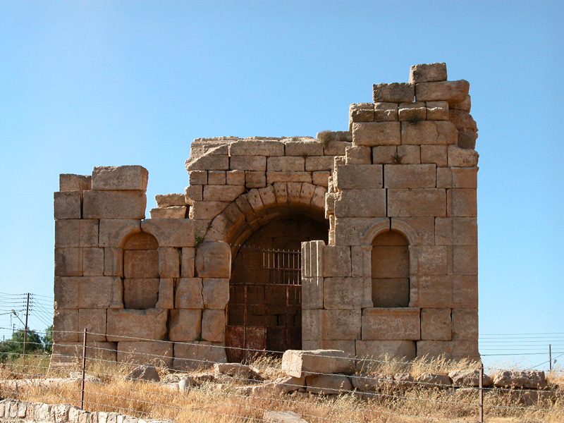
Harding mentions nothing else in this village, except for his short sentence “in the village behind can be glimpsed a few columns and remains of ancient walls.” This note actually refers to the more peculiar and, once, much larger monument. When Harding notes “ in the village behind” it is clear that he referred to some ruin that is actually almost exactly behind the more complete “Roman” temple if one stands in front of its main doorway. The reason that made Harding miss the upper monument remains unknown. Unless, most credibly, the upper monument was partially covered by some traditional village houses that were there in the 1950s and now no longer exist.
One can contemplate the origin of the name of this village. “Dhat Ras” could be translated as “The Place with a Head”. As village names are usually older than traditional houses, names used by pre-settlement shepherds for a destination of good grassland, the natural hill of this village before the traditional village was built would appear from far distances with a standing structure atop the hill’s shoulder. The “head” of Dhat Ras, then would be the fragile monument that crowns the highest part.
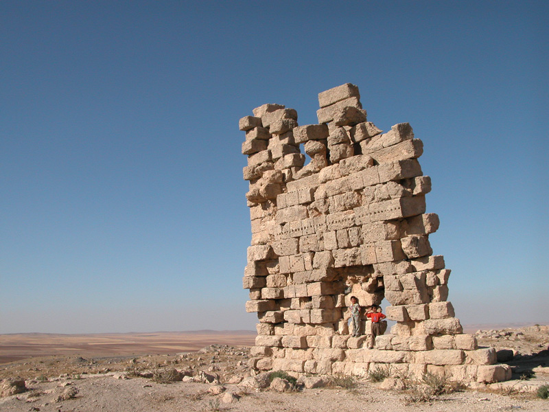
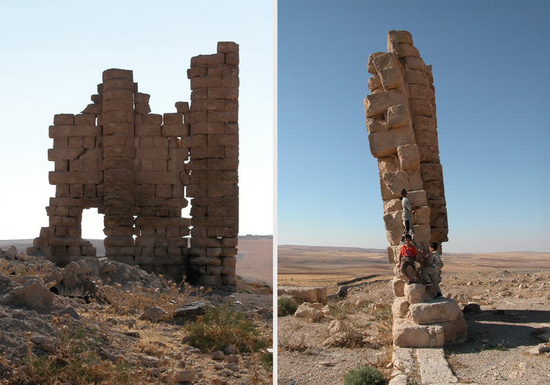
Unlike the lower, more complete, monument which actually looks Roman, the upper monument has only the northern half of its eastern elevation kept standing. The upper monument looks older and of more significance than the lower one, as its location on the uppermost spot represents the first choice of the more imposing position.
This monument, which the local children call “Al- Mi’dhana” (the Minaret), now stands up against all odds, with so many eroding stones that give it gaps through which wind and sun pass from one side to the other. Waiting for the final collapse, the monument hangs upwards like a rag with many holes, like some fragment of an ancient carpet made of a rare textile.
Standing to the south of this wall, you get a feeling of apprehension, wanting to hold it from falling to the ground, or making sure that you are ready to run from its eminent collapse. With all the time that this monument has accumulated, you get the feeling that it has held up just for your arrival, and then, for you to witness, it will collapse to a final rest.
This monument, which looks more Nabataean than Roman, once had walls with round pilasters on its outer elevations. Between the pilasters, in the upper part of the wall and just below the now missing capitals, a row of circular windows completed the composition. One can still detect the last three or four stones that outline segments of these circular windows, giving an accurate measurement of their radius. For comparison purposes, it would be appropriate to match the partial remains of this building with a similar Nabataean mausoleum in Suweida, Syria. This comparison can help us to understand the complete structure, keeping in mind that the monument at Dhat Ras seems to have been larger than the one in Suweida.
This ruin of Dhat Ras is a gem; it might fall at any moment, maybe while you are reading this article. Urgent and professional support (not renovation or re-construction) is needed before it is too late. Only by immediate consolidation intervention, can we avoid its eminent collapse –meanwhile it will soon get weary of leaning against the wind.
On the Desert Highway, some 26km after Qatarana, a paved road brings you west to the town of Al Mazar. After driving for about 12km from the Desert Highway, you pass the village of Mhai, followed by Um Hamaat. At this point ask for Dhat Ras, it’s only a few kilometers further. On the southeastern slope of the village hill, the small Roman temple can’t be missed, as the main village road passes next to it. To find the upper “Nabataean Mausoleum” you have to negotiate your way between the village houses and arrive to the higher point towards the northern end of the village. Roads leading to this monument are not all paved, and the traditional architecture around it is mostly deserted.A trip to Dhat Ras can be done in half a day, but a full day would be more relaxed. You can combine this destination with a visit to the more famous Karak castle, or drive back to Amman on the more meandering and more interesting Kings Highway. For a quick picnic try the fresh bread from the one of the villages with a tin of tuna and a lemon, all available in most of the village shops.